
Pico do Facho, Machico: The Best Hiking Routes — and Is It Worth It?
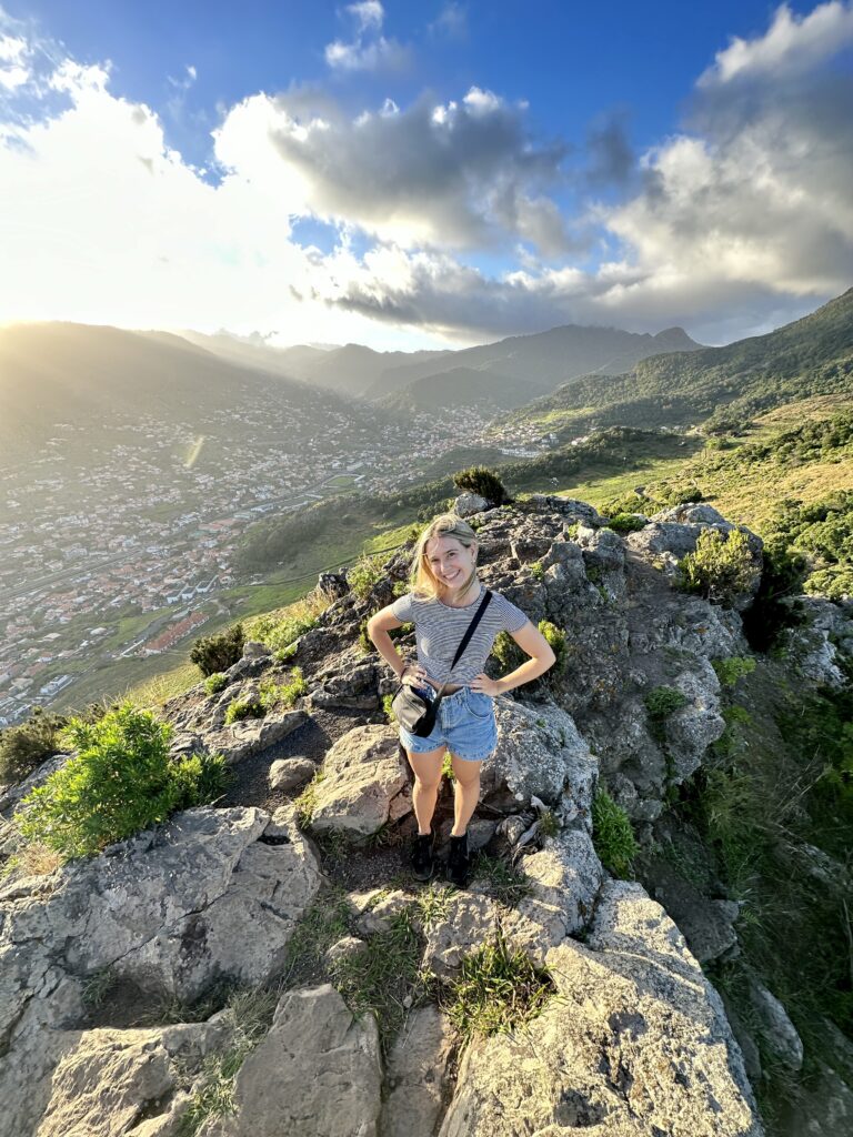
Pico do Facho, Machico, is one of my go-to hikes in Madeira, as well as one of my favourite things to do in Machico. The small mountain sits on the eastern side of Machico Bay, overlooking Madeira’s original capital city.
At only 517 metres high, Pico do Facho is one of the easiest mountain hikes in Madeira. From Praia de Machico (the city’s sandy beach), it’ll take most people a short climb of about 30 to 40 minutes to reach the summit.
I have hiked up Pico do Facho a handful of times in the past couple of years. I particularly like this hike because it’s on my doorstep — when I visit Madeira, I almost always stay in Machico — but also because it’s one of Madeira’s least busy hiking trails.
There are a few ways to do the Pico do Facho hike. The traditional route is to climb up and down using the same path (3.2 kilometres) but I love to extend the hike from the summit to Praia da Ribeira de Natal, a stunning pebble beach on the edge of Caniçal.
In this blog post, I’ll explain the best routes for climbing Pico do Facho, as well as whether it’s worth a spot on your Madeira itinerary. For more epic trails on the island, read my ultimate guide to the best hikes in Madeira.
Disclosure: This post may include affiliate links. If you decide to click through and make a qualifying purchase, I will receive a small commission at no extra cost to you – thanks for your support.
Where is Pico do Facho?
Pico do Facho (often misspelt as Pico Facho) is located in Machico, a small but historically significant city on the east coast of Madeira.
Machico was also the first landing point for the Portuguese when they discovered the island in July 1419. Therefore, it became the island’s first capital city, before being overtaken by Funchal in 1508.
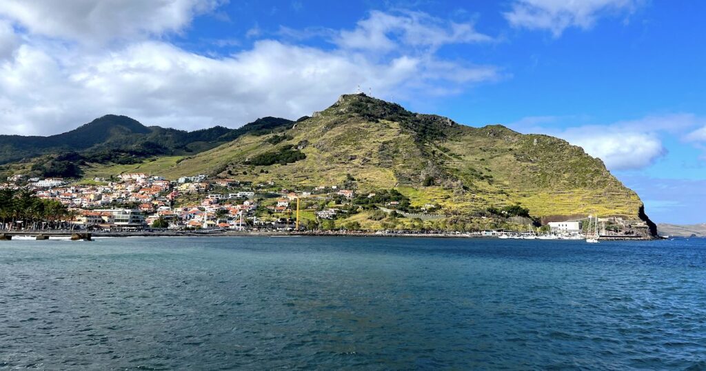
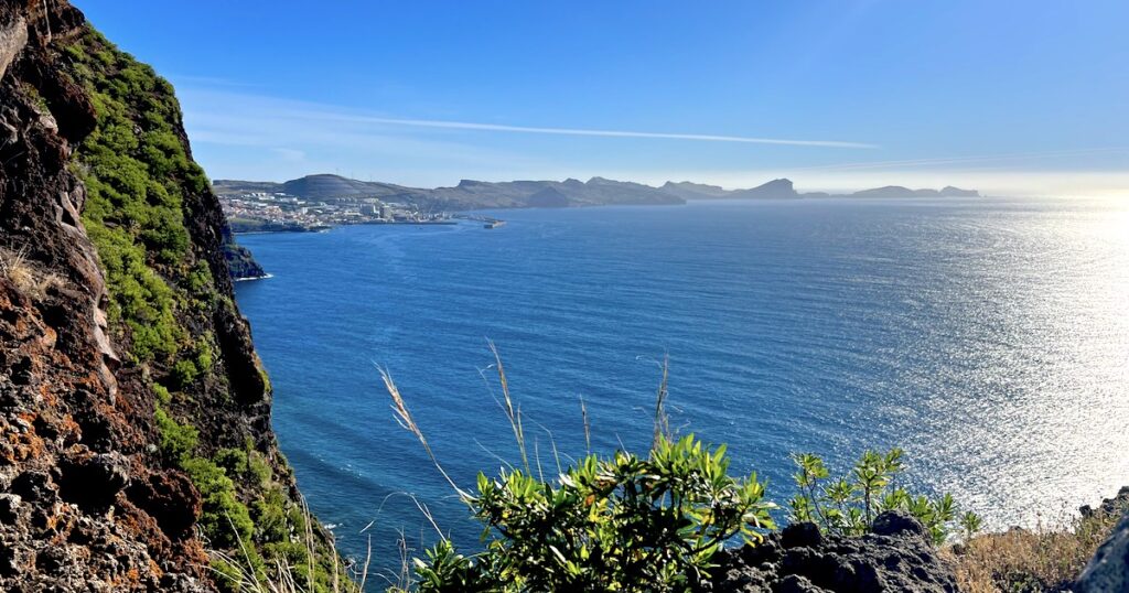
The mountain is on the eastern side of the bay, between Machico and the neighbouring fishing town of Caniçal. From parts of the mountain, you can also see the easternmost point of Madeira, Ponta de São Lourenço.
Is Hiking Pico do Facho Worth It?
It’s possible to drive directly to the mountain’s summit. However, if you’re willing and able, hiking Pico do Facho is far better. The views are stunning on the route up.
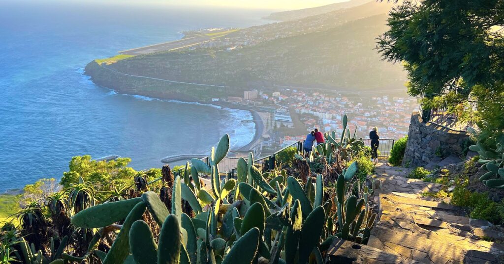
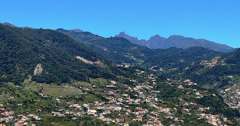
The mountain looks back over Machico Bay, where you can see the two separate beaches (one sandy and one pebbled), the terracotta tiles of the city, and the airport runway on the hill above.
The higher you get, the more you can see, including several more valleys behind the runway. And facing in the opposite direction, on clear days, you can also see all the way to Ponta de São Lourenço, the otherworldly easternmost point of the island.
The out-and-back Pico do Facho hike is moderately challenging, with just over three kilometres and 362 metres of elevation gain.
If you’re not experienced in climbing mountains, it may feel like a challenging climb because all of the elevation comes all at once. It’s not a gradual climb – once you reach the bottom of the mountain, the only way is up.
It’s also a good practice route if you’re thinking about tackling one of Madeira’s bigger peaks like Pico Grande or Pico do Arieiro to Pico Ruivo (PR1).
For an easier hike in Machico, I recommend hiking the zig-zag trail on the other side of Machico Bay (details are in my Machico travel guide) or Levada dos Maroços, a mostly flat walk through the back valleys.
How To Get There
The hike to Pico do Facho begins at the entrance to the levada on Desembarcadouro Road.
- By car: You can park next to the trailhead (there are a small handful of spaces) or at Machico Beach. From the beach car park, simply walk up the concrete stairs to the trailhead.
- By bus: From Funchal, you can take SIGA bus no. 113 to the bus station in Machico. From there, it’s a 15-minute walk to the trailhead.
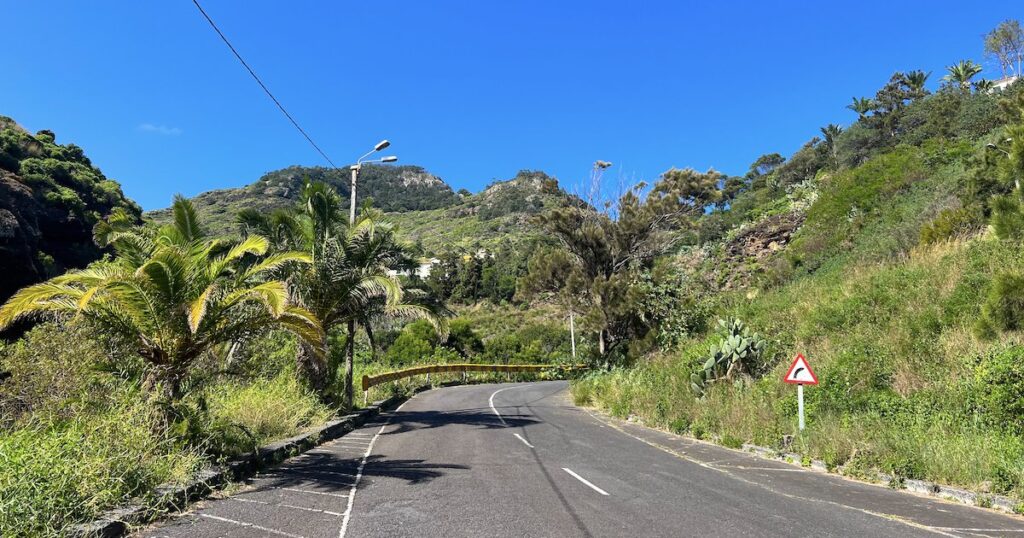
- Driving directly to the summit: As you can see from the map, there is also a road that goes directly from Machico to Miradouro do Pico do Facho. The summit ‘car park’ is very narrow, so making a three-point turn in a large car will prove a little difficult if there are several cars in the vicinity.
Pico do Facho Hike: What to Expect on The Out-and-Back Route
Route Map
My Experience Hiking The Standard Pico do Facho Trail
The standard Pico do Facho hike begins and ends near the sandy beach in Machico. There are no toilets along the trail, so make sure to stop by the public toilets at the beach if you need them!
You’ll start by walking along the levada above the bay, which is a flat but beautiful stretch that passes by houses and the occasional tethered goat grazing on the grass below the mountain.


Once you reach the very end of the levada, at the bottom of the mountain, you’ll begin your climb to the summit. It’s a dirt track that’s pretty easy to follow, with views all the way up to the top.
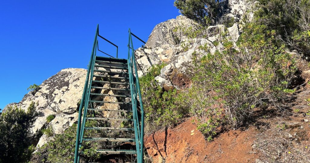
When you get near to the summit, you’ll come across a few steel staircases that’ll help you get over the last rocky part of the trail.
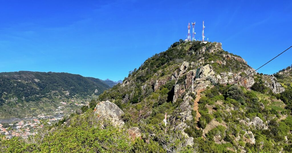
Eventually, you’ll emerge at the car park, and from there, just head left to the Pico do Facho Miradouro overlooking Machico Bay. There are a few picnic benches here, plus the occasional food van during the peak season.
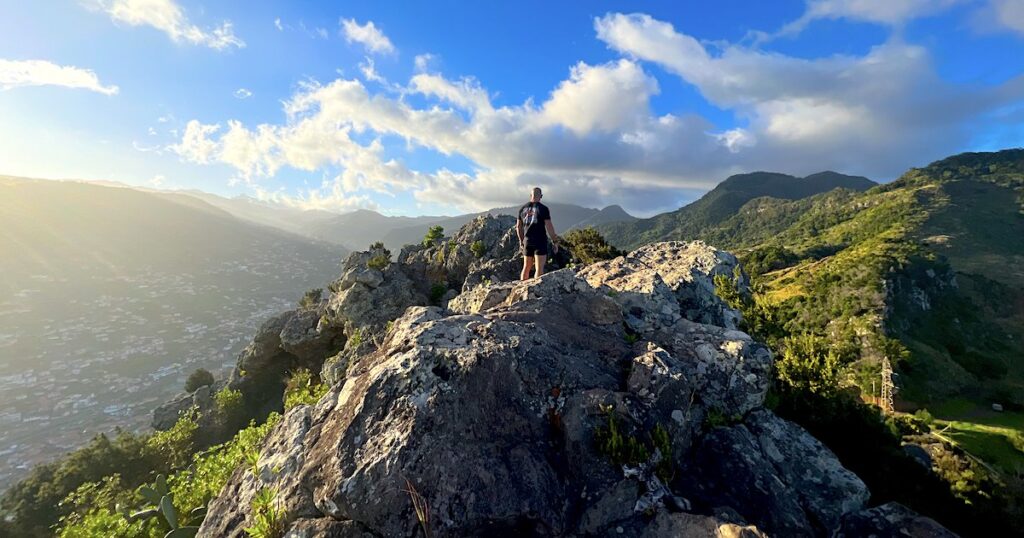
Now, this is where you want to pay attention, because many people don’t realise that there are more stairs to the official summit, marked by steel transmission towers.
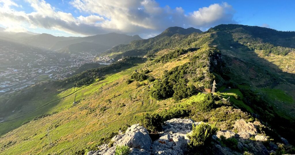
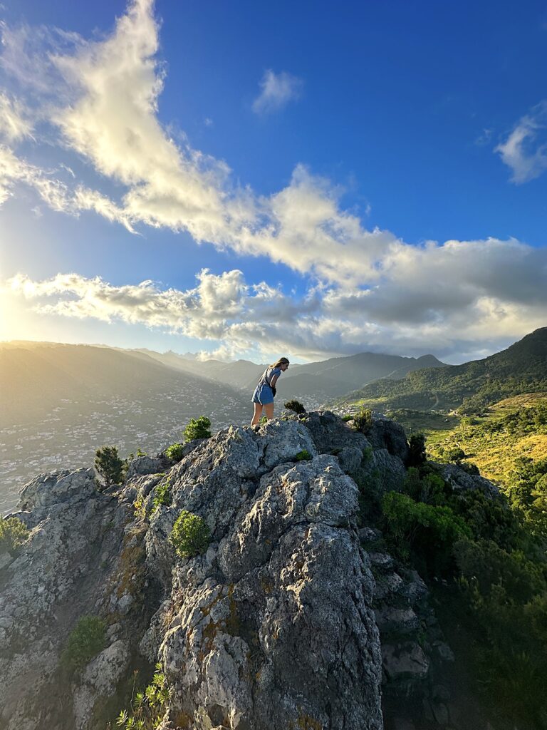
From there, I like to scramble a little off-piste. There is an area a little further up with some rock boulders offering views all the way to Pico do Arieiro (only on clear days) and over the back valleys of Machico.
This section does require you to have good balance and some basic scrambling experience, so please only proceed if you’re absolutely comfortable and confident in your skills. It has the best views out of anywhere on the mountain, and chances are, you will also have them to yourself.
That’s the end of the official Pico do Facho hike in Madeira. Once you reach the summit, all you need to do is hike the same way back down to Machico, or you can extend the hike to Praia da Ribeira de Natal as I’ll explain in the next section.
How to Extend the Pico do Facho Hike to Praia da Ribeira de Natal
From the summit of Pico do Facho in Machico, I almost always extend my hike to the stunning Praia da Ribeira de Natal.
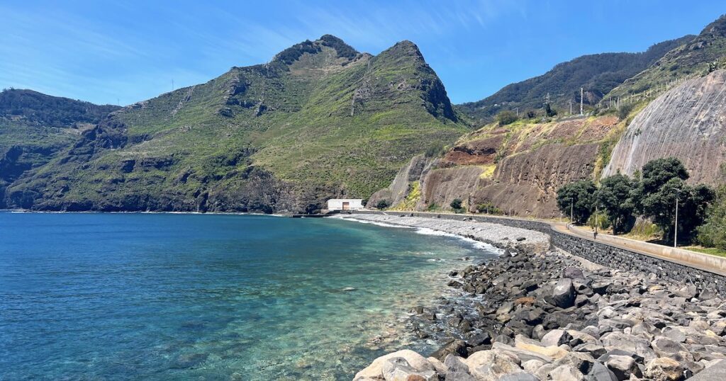
This rocky beach is located on the western edge of the fishing town of Caniçal, backed by steep hills and a long, tarmac boardwalk.
From the summit of Pico do Facho, it adds an additional 5.3 kilometres to your hike (around 2 – 3 hours, depending on your pace).
quick Stats: Praia da Ribeira de Natal Via Pico do Facho
Distance: 8.8 km
Elevation gain: 951 m
Time needed: 5 – 5.5 hours
Difficulty: Hard
Trail type: Out and back
Booking required? No
Route Map
What to Expect: My Experience Hiking to Praia Ribeira de Natal via Pico do Facho
The complete Praia Ribeira de Natal hike begins in the same place as the standard Pico do Facho route, near Machico’s sandy beach. (Although, if you want to cheat, you can drive to the Pico do Facho summit, cutting out the most difficult part of the walk.)
From the summit, follow the road around to the right and within two to three minutes, you’ll arrive at a dirt-grass track heading east along the coast.

For this hike, I very much recommend following the AllTrails route map because it’s easy to lose track of the path. And this wouldn’t be a fun place to get lost, between the mountain and the sea.
The trail hugs the hilly coastline, following a grass and dirt track up and down a couple of small slopes before coming to views of Caniçal and Ponta de São Lourenço.

After 1 – 1.5 hours of walking, you will arrive at a small bridge over a stream. Down the road is Praia Ribeira de Natal, a long pebble beach with very blue water.
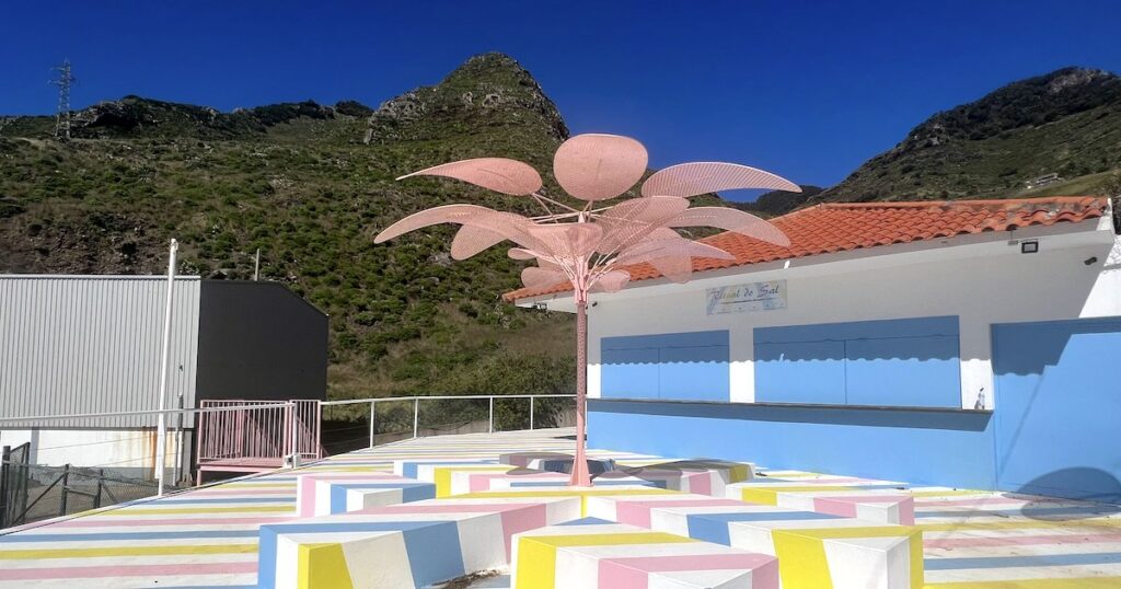
At the entrance to the beach, there is a beach bar with blue shutters and benches with pink, white and blue stripes.
I quickly worked out that the bar typically opens on weekends during the summer (and not every weekend, mind you). I’ve been there when it’s open and closed; it’s a lovely little spot when busy.
There are changing rooms and toilets around the back, but again, they’re not always open. In the event that they’re closed, the nearest toilets are in Caniçal, within 15 minutes’ walk of the beach.
There are also a couple of outdoor cold-water showers, which are always accessible.
As I explain in my guide to Praia da Ribeira de Natal, I like to walk out along the stone pier, and depending on how high the water is, I jump into the water or climb down the stairs for a swim. In summer, there is a swimming pontoon located in the bay, where I lay back and sunbathe.
After spending some time at the beach, there are a few options for your return route. You can, of course, hike the same route back to Machico.
But if you don’t want to do that, you can stroll around 15 minutes into Caniçal for some coffee and seafood. From Caniçal, there is an hourly bus back to Machico: number 113 from the SAM bus stop.
I also ordered a Bolt car back to Machico once, although whether you get a driver or not is a matter of luck because this isn’t a busy route.
Tips for the Hikes
- Pack plenty of water and snacks. There’s nowhere to buy water along the route (except for at the beginning, near the sandy beach).
- Consider rain and sun protection, as the hike is open to the elements. On sunny days, you’ll definitely burn!
- Download an offline map, especially if you’re extending the hike to Caniçal.
- Pack first-aid, just in case. There are some cacti at the mountain summit, so it’s easy to scratch yourself if you’re distracted for a moment.
I hope you found this guide to the Pico do Facho hike useful! Let me know in the comments below whether you tried either of these two routes, and your tips for the next hiker.


