Pico Grande Hike Guide: The Most Underrated Mountain Hike in Madeira
The Pico Grande hike in Madeira is so good I had to go back for seconds.
The first time I did this underrated mountain hike, I’d already hiked the island’s most famous mountain trail, Vereda do Areeiro (PR1), and wanted to experience the mountains without the crowds.
I first did a very challenging 20+-kilometre route to Pico Grande from Encumeada. Then, when I went back last year, I did the easier and more popular 10-kilometre route near Funchal to give you a guide to both routes.

In my Pico Grande hike guide, I’ll explain what makes the Pico Grande hike so special. I’ll cover the two viable routes to Pico Grande, explain how difficult they area and considerations like trail bookings, weather and how to get there
For more of the best hikes in Madeira, check out my dedicated guide with 22+ hikes I’ve personally done.
What Is The Hike To Pico Grande?
Pico Grande is a challenging but rewarding mountain trail in Madeira, with views of the island’s central peaks and Curral das Freiras (Nun’s Valley).
At 1,654 metres high, the mountain is the 8th-highest peak in Madeira and a popular alternative to the busier PR1 trail.
Which Pico Grande Route Should You Choose?
There are two main trails to Pico Grande. I’ve done both, and they’re very different.
I recommend the PR12 route from Boca da Corrida for most people, but in this guide, I will cover both routes and how they compare. Jump to:
- Best for most hikers: Pico Grande via Caminho Real da Encumeada (PR 12) begins at a viewpoint 20 minutes’ drive from Funchal. It’s the shortest route (9.7 kilometres), doable for hikers with a good base fitness level.
- Best for those wanting a challenge: Pico Grande from Encumeada is a 20+-kilometre trail that I only recommend to experienced hikers ready for a full day in the mountains. It’s a 40-minute drive from Funchal, near São Vicente.
Note: Both Pico Grande trails are subject to occasional closures. You can check the status for classified trails online; look at the PR12.
Both hikes use part of the PR12, so they require an advance booking on the SIMplifica portal for €4.50.
Should You Do The Hike To Pico Grande?
If I could only choose one mountain hike in Madeira, it would be Pico Grande. While I love the PR1, it’s very crowded, so Pico Grande feels much more relaxing and wilder, as the mountains should be.
That being said, it’s not for everyone. Both routes to the summit are challenging and best-suited to people with a good base level of fitness and experience hiking in the mountains.
Do You Need A Car to Hike Pico Grande?
You need a car to hike Pico Grande. The trailheads are located in mountain passes without bus routes, and the mountain is not well-served by tours and hiking transfers yet.
If you don’t have a car, I recommend reading my guide to hiking in Madeira without a car, where I round up the best hikes you do by bus, transfer or tour.
My favourite car-free alternative to Pico Grande is the PR1, which you can reach using the PR1 hiking transfer.
If you’re considering driving, my guide to renting a car in Madeira covers everything from road conditions and costs to whether it’s worth it for more than one day.
Is Pico Grande Harder Than The PR1?
I would say that Pico Grande and the PR1 are similarly matched in difficulty. They’re a similar length and both have 850–950 metres of elevation gain.
That being said, I do find Pico Grande more technically challenging. While the PR1 has steel staircases and exposed sections near the beginning, it’s generally well-defined, busy and has clear railings and infrastructure.
In comparison, Pico Grande is less well-maintained. The terrain is challenging, with slippery gravel slopes, narrow sections of exposed paths and a short scramble with fixed ropes at the summit.
My Recommended Pico Grande Hike: Pico Grande via The Caminho Real da Encumeada (PR 12)
Best for: Most hikers – you need to be fit, but it’s the easiest trail and nearest route to Funchal.
Distance from Funchal: 20 minutes’ drive
Quick Stats
- Distance: 9.7 km
- Elevation gain: 841 m
- Time needed: 3.5 – 5 hours
- Trail type: Out-and-back
- Difficulty: Hard
- Booking required? Yes (via PR12)
Difficulty
For most people with a good base level of fitness, the hike to Pico Grande via the PR12 (Caminho Real da Encumeada) is doable.

It may not be the longest trail in Madeira, at 9.7 km, but it has a lot of up and downs, totalling 841 metres of elevation gain.
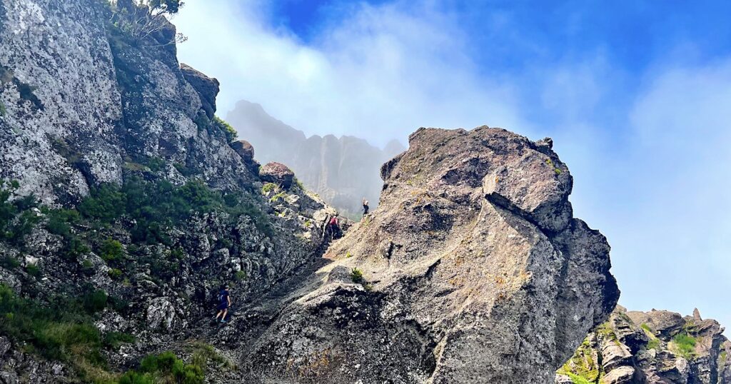
What surprised me most wasn’t the distance or elevation gain. It was the exposure near the summit. Several sections felt more intimidating than I’d expected from reading other hiking guides. Some narrow parts of the trail have a steep drop on one side, blocked only by bushes.
There’s also a long section where you’re hiking uphill on loose dirt, rocks and gravel – quite slippery in areas – and to reach the summit, there’s a scramble using fixed ropes.
The scramble looks worse than it is, but it’s also not something I’d encourage nervous hikers to push through. Several people turned around when I was there, and honestly, I think that’s the right decision if you’re uncomfortable.
How to Get To The Car Park For Pico Grande
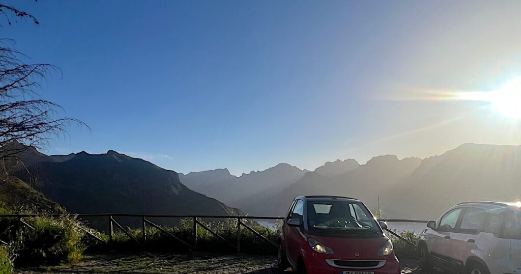
Park at the Boca da Corrida viewpoint 20 minutes’ drive from Funchal.
There is very limited space, with room for only 5–6 cars, so try to get there early (ideally before 8am). Many people park on the road after that, but it’s narrow and doesn’t have much space either.
What to Expect On The Pico Grande Hike Via the PR12
Route Map
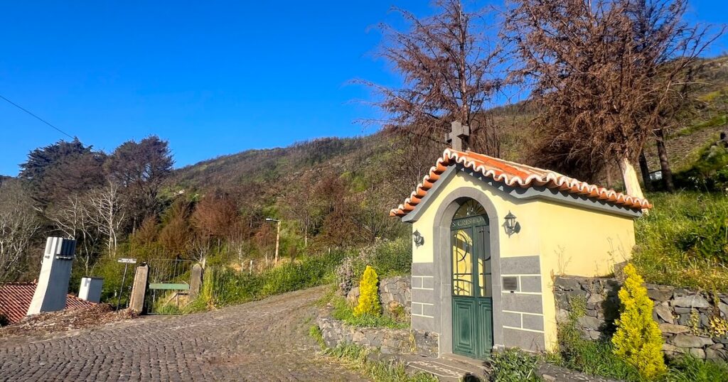
The trail begins behind the small yellow building. The route is easy to follow on AllTrails – I recommend downloading the offline map in advance, as there isn’t good 4g or 5g signal in the mountains.
My Experience Hiking to Pico Grande Via The PR12
I began hiking at bang-on 8am, when there were already several cars in the car park. The earlier you can begin hiking, the better for parking and having less crowds on the trail.
At 8am, the views from the car park were spectacular with clouds blanketing the mountains.
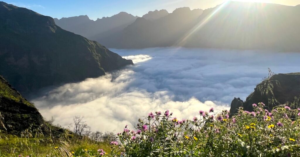
I found the beginning of the trail the easiest, as it’s a wide, cobbled path along the mountainside with thistle bushes and long grass on either side.
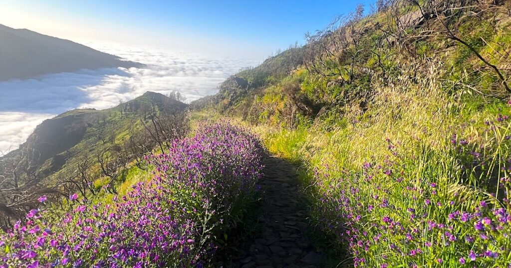
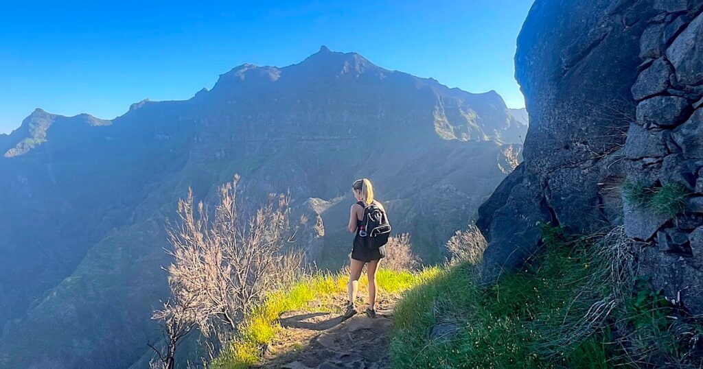
After about an hour and a quarter, hiking started to feel harder. The path gradually becomes narrower and steeper, clinging to the side of a mountain as it snakes up to the summit.
My attention turned away from the views and onto my feet, especially in some areas where there are only bushes separating the path from a steep drop.
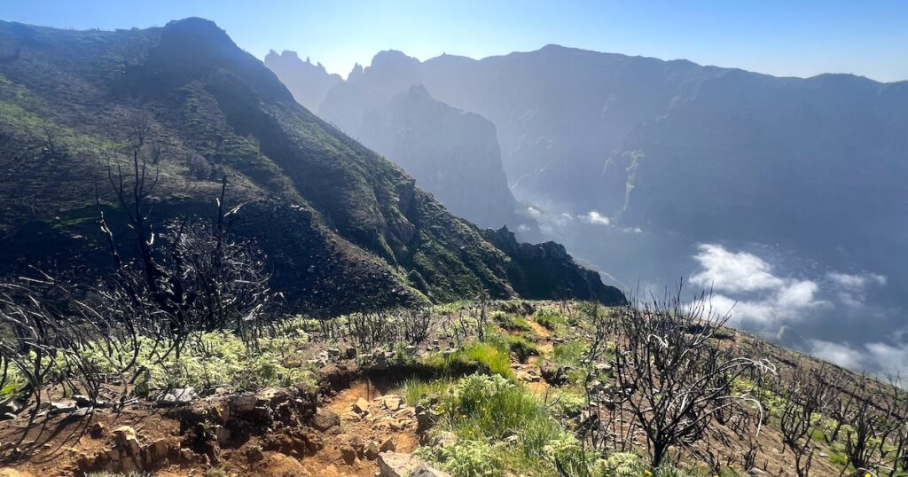
Once you’re past that section, you reach the last, long slog to the Pico Grande summit. I’ve never been a huge fan of hiking on loose dirt, rocks and gravel, so this was my least favourite part of the hike. Particularly on the way back, when I was slipping downhill!
In all, with a couple of small breaks, it took me 2.5 hours to climb up to the summit from the car park. I’d already been to the summit once before – on the route from Encumeada, which I’ll cover in more detail below – so I already knew what to expect.
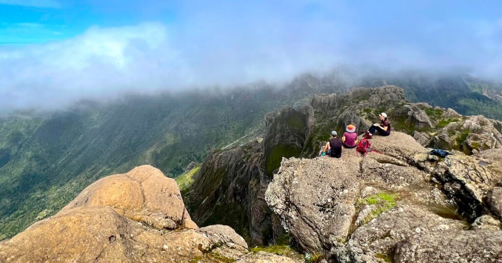
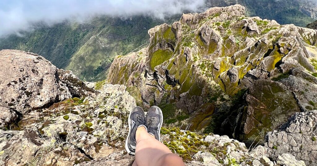
At the summit, there’s a short but intimidating scramble to the summit with fixed ropes to assist you. The best views are from the top of the rock, so it really is worth the scramble if you’re feeling confident enough.
It’s much easier with a confident hiking partner, especially when you’re scrambling back down. In one place, it’s hard to see your feet, so it’ll help having someone below to guide you to the footholds.
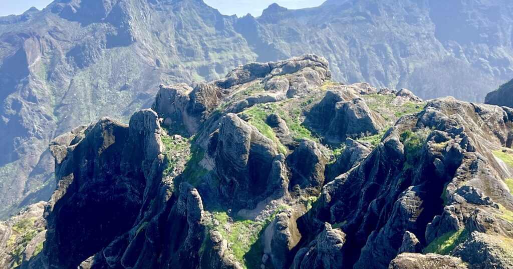
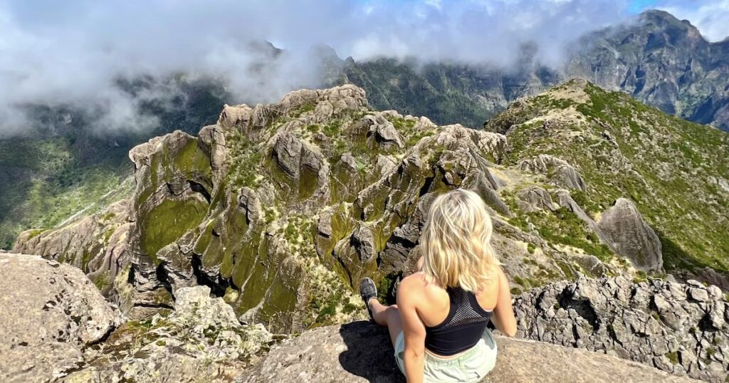
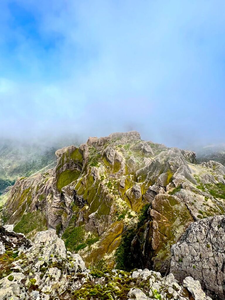
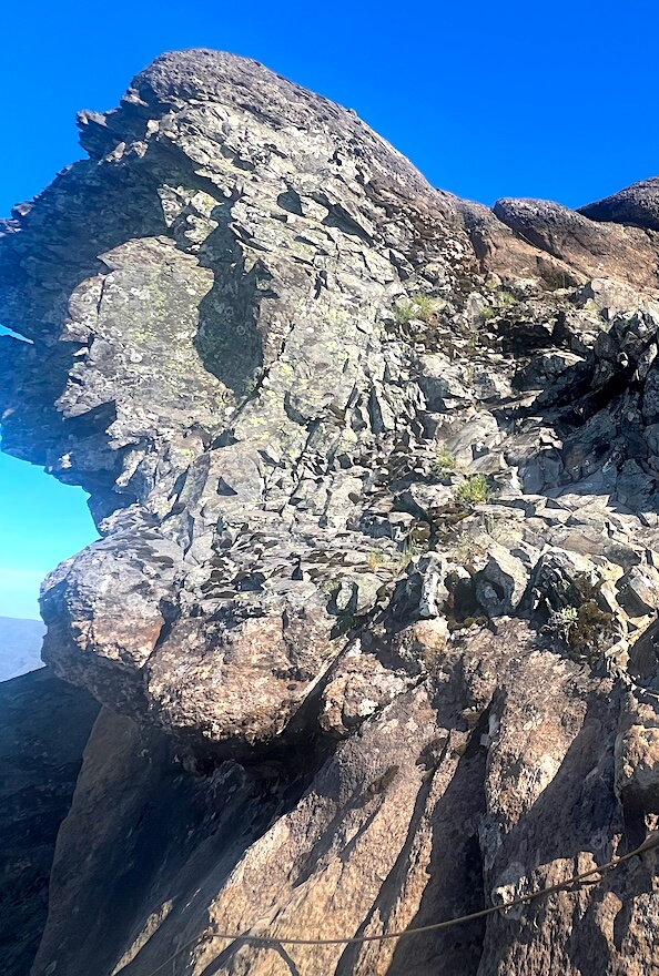
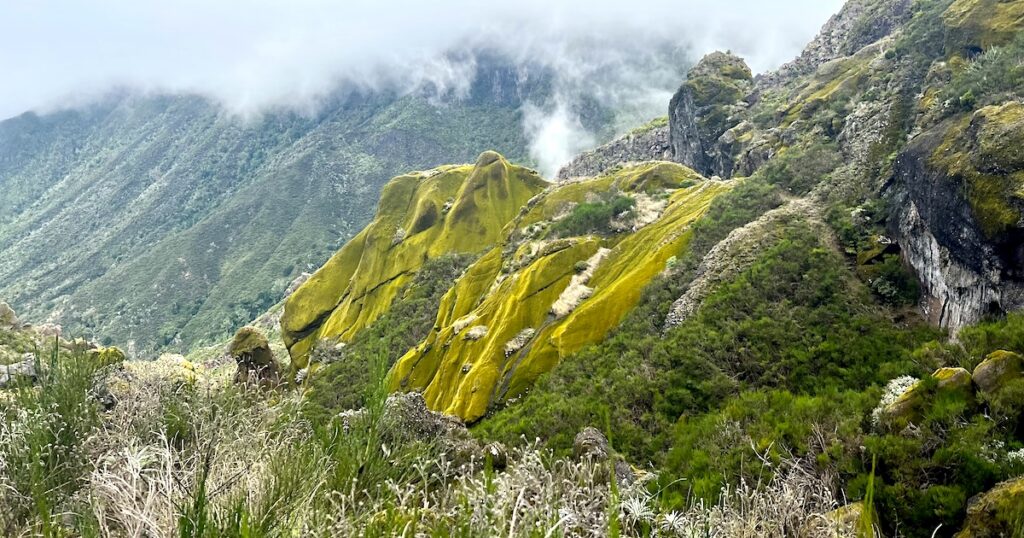
The summit is basically a large boulder where you can sit down and admire the views over Madeira’s mountains. I particularly love the swirling rock formation, which changes colour depending on the season.
When I visited the summit in May, it was a lush green. In October, it was a mossy yellow.
After admiring the views, it took me around 1.5 hours to hike back, bringing the hike to a total of 4 hours – but some people are quicker or take longer depending on their pace.
Your Second Option: The Pico Grande Hike From Encumeada
If you’re up for the challenge, and the conditions are good, you can try the more challenging route to Pico Grande from Encumeada. The views are totally different on the way up – here’s what I made of it.
Quick Stats
- Distance: 20.3 km
- Elevation gain: 1,417 m
- Time needed: 7–10 hours
- Trail type: Out-and-back
- Difficulty: Very hard
- Booking required? No
Difficulty
The route to Pico Grande from Encumeada shouldn’t be underestimated. I did the hike in late 2023 with a group of pretty hardcore hikers, so we knew what we were getting into.
And in fact, back then, we did the circular route – which has now been closed for some years – which added an extra four kilometres to the standard point-to-point trail.
I only recommend the 20-kilometre Pico Grande hike from Encumeada to confident, experienced hikers who are well-prepared for a long day on the trail (often up to 10 hours) and 1,417 metres of elevation gain.
You’ll need to start the hike early, ideally before 7.30am, and make sure the conditions are clear and rain-free because the trail isn’t as well-maintained as the other route. In rain, small waterfalls block the way, and the area becomes prone to landslides.
How to Get to The Encumeada Pico Grande Trail
The trail begins in Encumeada, near São Vicente on the north coast. You need a car to reach it, as it’s a 40-minute drive from Funchal.
Staying closer helps; you can check out my guide to where to stay on the north coast, but I personally recommend Granny’s Farm which is a 20-minute drive from the trailhead.
There’s limited road parking at the trailhead. Several trails begin in the area, including the PR17 and Levada das Rabaças, so it can quickly get full.
There’s a restaurant in Encumeada with coffee, snacks and toilets. I often buy boiled eggs there in order to use their loo before hiking.
What to Expect When Hiking Pico Grande From Encumeada
Route Map
The trail begins from behind the snack bar in Encumeada, marked by two signposts to Pico Ruivo and Achada do Teixeira. It looks like a gravel slope going into the trees.
My Experience
You don’t get an easy start on this route. Right from the very beginning, you’re put to work; there’s a kilometre of stairs climbing uphill, before you emerge at a beautiful open ridge (misty, for us). I was panting within minutes.
After this, you’ll then spend most of the hike (around 1–2 hours) hiking through bushes and trees along a wild trail, with quite a bit of up and down.
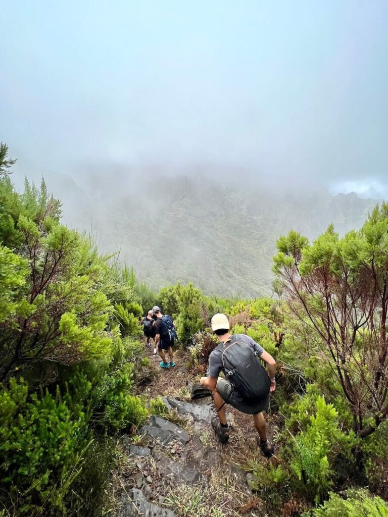
I had to focus quite a bit, because the trail isn’t well-maintained and there were obstacles like fallen trees.
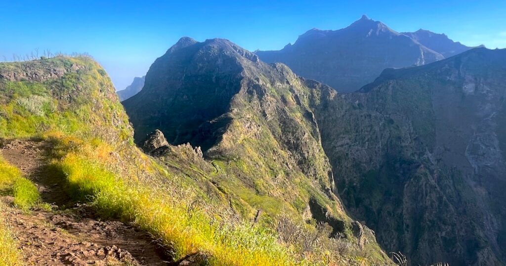
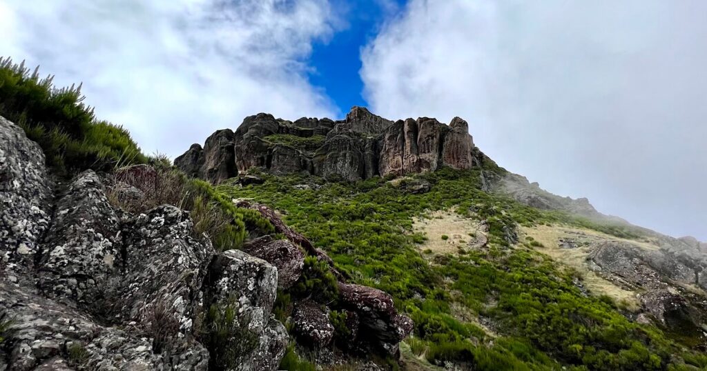
About seven kilometres into the route, the trail opens up into a really nice area where you can spot the summit of Pico Grande high above you.
There are also views of surrounding mountains, including some really fun mossy-looking rock formations.
This was my favourite part of the hike, and I got some super-cool pics of our group ascending the boulders towards Pico Grande.
Finally, at the 10-kilometre mark, you will reach the summit of Pico Grande and be faced with the same scramble that I covered on the previous route.
There are fixed ropes to help you to the top of the boulder, where you’ll find the best views of swirling rock formations and Madeira’s inner mountain range.
At this point on the trail, we took a long, circular route back to the car park in Encumeada. However, this is no longer an option due to ongoing works in the area, so you’ll need to follow the same route back to your car.
Tips For Hiking Pico Grande
- Bring 2–3 litres of water per person: There are no cafés, shops or water refill points along either Pico Grande route, and the exposed sections can feel hot even on mild days.
- Pack enough food and snacks: I always pack a proper lunch as well as a few easy snacks such as nuts, fruit or cereal bars for the summit.
- Carry a basic first-aid kit: Even a small kit with plasters, blister patches and painkillers is worth having on a mountain hike like this.
- Wear proper hiking shoes or trail runners: The trail includes loose gravel and steep inclines. I personally prefer trail running shoes as they’re more nimble for the scramble at the summit.
- Hike with a partner. Unlike the PR1, Pico Grande is relatively quiet. When I hiked it, there were long stretches where I saw very few people. Having a hiking buddy is useful for motivation on the trail as well as safety.
- Start early. The Boca da Corrida car park is small and fills up quickly. An early start also means cooler temperatures and fewer people on the trail.
- Check the weather forecast before setting off. Pico Grande is all about the mountain views. Low cloud can completely obscure the scenery. You also want to avoid hiking in the rain, as some areas will feel slippery.
Alternatives to Pico Grande
- PR1 (Pico do Arieiro to Pico Ruivo): The most camparable hike, just as challenging. It’s arguably the most famous hike in Madeira, so it’s very crowded, but it’s easy to reach with a wide range of PR1 hiking transfers and tours available.
- O Caminho do Pináculo e Folhadal (PR17): My favourite alternative to Pico Grande, beginning in Encumeada. It’s challenging, with 15+ km and 1,200 metres of elevation gain, but you get epic mountain scenery and waterfalls.
- Eagle Rock (Penha de Águia): A shorter mountain hike on the east coast that will give you the feeling of climbing a mountain but in only 2–3 hours. It’s a good warmup for Pico Grande.
FAQs
I wouldn’t recommend Pico Grande for complete beginners. While experienced hikers shouldn’t have any issues, the steep terrain, exposure and summit scramble make it more challenging than many of Madeira’s levada walks
No. Wild camping is generally prohibited in Madeira unless you’re staying in an authorised camping area or have obtained permission from the relevant authorities. While you may see people recommending camping on Pico Grande, I wouldn’t advise it. If you’re looking for an overnight mountain experience, it’s best to use one of Madeira’s designated campsites instead.
The PR12 route typically takes between 3.5 and 5 hours, depending on your pace and how long you spend at the summit. The longer Encumeada route can take most of a day.
I hope you found my guide to hiking Pico Grande helpful! I loved doing both of these routes so that I could give you a complete picture of Pico Grande.
Please leave a comment below with your own experience on the mountain. I’d love to hear from you.