
Hiking in Madeira Without a Car: The Ultimate Guide
Don’t trust anyone who tells you that you can’t go hiking in Madeira without a car.
While you won’t be able to reach each and every hike on the island, you can still have a rewarding day on the trails.
I spent 6+ months on the island, the majority of it without a car, and learnt first-hand that there are plenty of hikes that you can reach by bus from Funchal or by utilising hiking tours and transfers.

In this guide, I will cover the specifics of hiking in Madeira without a car, including how to use the public transport and when to lean on tours.
As I say in my ultimate guide to visiting Madeira without a car, the great thing about the island is that many of the most popular and best hikes in Madeira are accessible by transfers or guided tours!
Disclosure: This post may include affiliate links. If you decide to click through and make a qualifying purchase, I will receive a small commission at no extra cost to you – thanks for your support.
The Basics: How to Go Hiking in Madeira Without a Car
Driving in Madeira is challenging, especially if you’re not familiar with the roads – believe me, I learnt first-hand!
If you’re not up for the challenge, don’t worry. It’s not only possible to go hiking in Madeira without a car – it’s easy.
Will you be able to reach each and every trail on the island? No. However, you will be able to reach the most popular hikes (and a handful of others) if you plan ahead.
There are three main ways to go hiking in Madeira without a car:
- Take the bus. If a bus route is available, you can go hiking on the cheap. Unfortunately, most (but not all) of Madeira’s hiking trails are not accessible by bus.
- Arrange a hiking transfer. Transfers will take you to and from the trailhead, leaving you to hike in peace. They’re ideal for point-to-point hiking trails like the PR1.
- Take a guided hiking tour. Group tours include a professional local guide and hotel drop-off and pick-up within Funchal. You’ll arrive, hike and leave as a group.
Remember to check the up-to-date list of trail closures in Madeira before you go hiking in Madeira. All classified trails (numbered PR trails) must also be pre-booked on the SIMplifica portal.
Where to Stay in Madeira If You’re Going Hiking in Madeira Without a Car
Where you stay is very important if you’re hiking in Madeira without a car. When you’re renting a car in Madeira, you can get away with staying pretty much anywhere; most of the island’s within 1.5 hours’ drive.
However, if you’re only using buses and transfers/tours, you ideally need to stay in Funchal.
As I explain in my complete guide to the best places to stay in Madeira without a car, most hiking tours and transfers will only pick up guests from hotels in Funchal.

One alternative is to stay in Caniço, which has a 30-minute direct bus to Funchal. However, for tours, you will need to take this bus to Funchal for the early-morning pick-up – annoying if you don’t like early starts.
Good Bases in Funchal without a car
The trick is to stay in a hotel that’s as central as possible, so that you’re within the pick-up area for tours.
It doesn’t matter too much if you stay on the outskirts of Funchal (e.g. in Lido), as you can easily take a bus or Bolt to the centre.

Hotel Madeira (£££)

Pestana CR7 Funchal (£££)

Barceló Funchal Oldtown (£££)
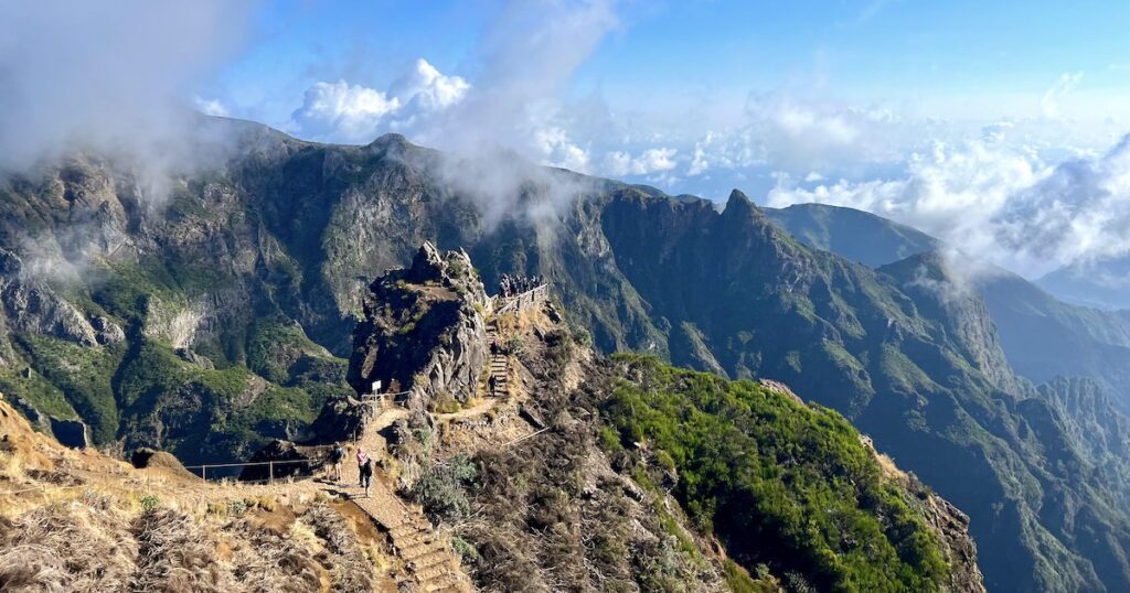
1. PR1: Pico do Ariero to Pico do Ruivio without a car
- Distance: 8.7 km
- Elevation gain: 955 m
- Time estimate: 4.5 – 5 hours
- Trail type: Point-to-point
- Booking required? Yes
- View route map on AllTrails
The Pico do Ariero to Pico do Ruivio (PR1) hike is perhaps the most famous hike in Madeira due to its narrow ridges, dramatic mountain scenery and steep stairs. And it’s so easy to do without a car!
It’s a point-to-point trail connecting two of the island’s highest mountains, Pico do Ariero (1,818 metres) and Pico Ruivo (1,861 metres).

There are no public buses, so a solution was needed that would mean hikers don’t have to hike all the way back to the start point at Pico do Ariero.
Local guides created hiking transfers that will drop you off at the trailhead on Pico do Ariero and pick up up near the end point, at Achada do Teixeira.
These self-guided hikes are available at sunrise or in the morning.
If you’re not an experienced hiker, you can also opt for a guided group PR1 hike with an experienced local guide.
‘Pico to Pico’ is a well-trodden, busy route with very good signage, but it’s also challenging, with a total of 955 metres (3,133 feet) of incline, and does have some areas that are prone to rockfall. So, hiking with a group can help you feel more confident.
2. Vereda do Larano without a car
- Distance: 9.8 km
- Elevation gain: 953 m
- Time estimate: 4 – 5 hours
- Trail type: Out-and-back
- Booking required? No
- View route map on AllTrails
Vereda do Larano may not be one of Madeira’s numbered trails, but it’s one of the island’s most famous coastal walks – and, I argue, far more scenic than Ponta de São Lourenço.

The coastal trail hugs the cliff on the east coast of Madeira and comes with views of the sea, steep cliffs and São Lourenço.
From the beginning of the trail, you can also see the town of Porto da Cruz and its mountain Eagle Rock.

Best part is you can do Vereda do Larano without a car, by booking this hiking trip with a local, which visits Vereda do Larano on Tuesdays only.
3. PR8: Ponta de São Lourenço without a car
- Distance: 10.5 km
- Elevation gain: 510 m
- Time estimate: 3.5 – 4 hours
- Trail type: Out-and-back
- Booking required? Yes
- View route map on AllTrails

Ponta de São Lourenço (PR8) is Madeira’s most famous coastal hike. Located at the easternmost point of the island, the hike explores the island’s long, volcanic peninsula.
With basalt and limestone rock, the peninsula has a dusty, brown-red appearance. The unique landscape is home to many rare plants and nesting seabirds.

Personally, Vereda da Ponta de São Lourenço is not my favourite hike on the island because it gets very busy. However, it does offer a sensational sunrise – and it’s easy to do even if you’re not renting a car.
If you select the 6am drop-off for the self-guided PR8 hike, you can make it to the trailhead for the ocean sunrise. (In summertime, the sun typically rises around 7:40am in Madeira.)
If you don’t fancy waking up early, the 8.30am or 10am drop-off times are far more reasonable. However, they are also very busy, as not only will you be hiking with other late risers, but you’ll see the early risers heading back in the opposite direction.
4. PR6: Levada das 25 Fontes without a car
- Distance: 7.6 km
- Elevation gain: 465 m
- Time estimate: 3 – 3.5 hours
- Trail type: Out-and-back
- Booking required? Yes
- View route map on AllTrails
Here’s a hike that’s totally different from the first three: Levada das 25 Fontes (25 Fontes) is one of the most popular waterfall hikes in Madeira.

There are many spectacular waterfalls in the Rabaçal Valley. which has complex levada irrigation channels. Many of them can be reached along levada trails, like Levada das 25 Fontes.
25 Fontes (meaning ’25 Waterfalls’) refers to the waterfall’s unique crescent appearance, which creates many (or 24, if the name is to be believed) small trickles.

There are several different routes to 25 Fontes, including the very flat, very easy Levada do Risco.
However, most tours (including this Rabaçal Valley guided walk) will usually take the most scenic route, Levada das 25 Fontes, which has 465 metres of incline and takes around 3 hours.
On this route, you will see additional waterfalls in the distance. Keep your eyes peeled at the beginning of the trail, before you enter the tunnel.
5. PR9: Levada do Caldeirão Verde without a car
- Distance: 11.9 km
- Elevation gain: 1,333 m
- Time estimate: 7.5 – 8.5 hours
- Trail type: Out-and-back
- Booking required? Yes
- View route map on AllTrails
Beginning near Santana, on the northeast side of the island, Levada do Caldeirão Verde (PR9) is a slightly more challenging waterfall trail.
It heads out and back to a 100-metre waterfall, which plunges into an amphitheatre-like pool. Passing mostly through the laurel forest, the hike has a nice variety of views over the mountains, forest and ocean.
It also heads through several mossy tunnels, which help to cut down the amount of elevation. Nevertheless, with 1,333 metres of incline, the hike is still very challenging.
You can easily do the PR9 hike without a car by booking a PR9 hike transfer to the beginning of the trail (at Queinmadas) and downloading the Levada do Caldeirão Verde map on AllTrails.
The guided hiking trip with a local also visits the PR9 trail on Wednesdays. If that fits in with your itinerary for hiking in Madeira without a car, it could be handy.
6. Caminho das Voltas to Nun’s Valley (Curral das Freiras) hike without a car
- Distance: 1.5 – 2 hours
- Elevation gain: 50 m
- Time estimate: 1.5 – 2 hours
- Trail type: Point-to-point
- Booking required? No
- View route map on AllTrails (end the hike in Curral Das Freiras)
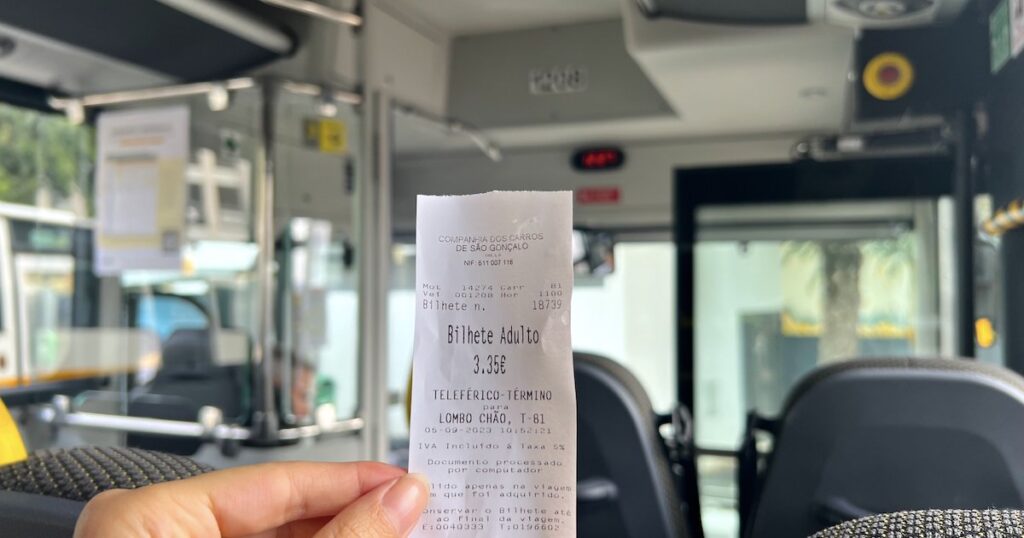
For this hike, you don’t need to book a hike transfer. The hike from Eira do Serrado viewpoint to Curral das Freiras (Nun’s Valley) can be easily done by bus from Funchal.
As long as you don’t mind walking downhill, this is one of the easier hikes on this list. The hike begins at the Eira do Serrado viewpoint (complete with a café, gift shop and toilets) and is completely downhill.

You can then catch the same bus from the bottom of the valley back to Funchal. If you really want to, there’s also the option to hike back up the same route, but that means hiking completely uphill.
Here are the details for the downhill-only route: First of all, you need to take the no. 81 bus (for Curral das Freiras) from the bus station next to the Funchal Cable Car.
You can check the Horarios do Funchal no. 81 bus timetable in advance online (select interurban routes).
To reach the Eira do Serrado viewpoint, you need to look for the buses marked with b) or e) on the timetable.
Once you arrive at the viewpoint, you can take some time to stroll along to the viewpoint or grab a coffee in the café/gift shop – both have spectacular views over the Nun’s Valley.

When you exit the café/gift shop, there is a wooden signpost on the left for Curral das Freiras.
This points to the beginning of the hike, which is basically a zig-zag path down the side of the mountain. From there, it’s very easy to follow.

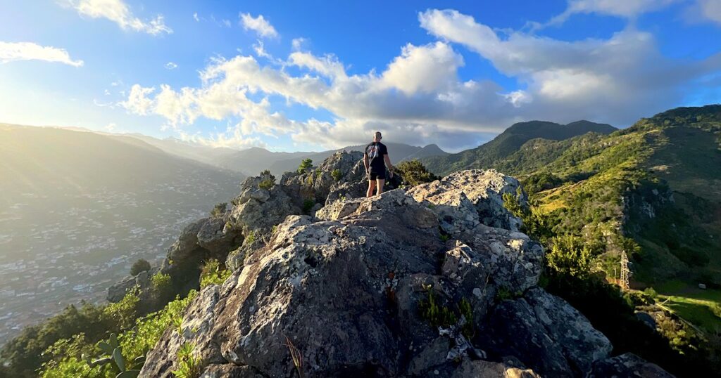
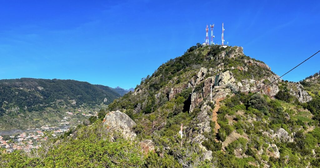
7. Pico do Facho (Machico) without a car
- Distance: 3.2 km
- Elevation gain: 362 m
- Time estimate: 2 – 2.5 hours
- Trail type: Out-and-back
- Booking required? No
- View route map on AllTrails
If you’re keen to go hiking in Madeira without a car, Pico do Facho is another hike you need to know about.
The short but scenic mountain hike is located in Machico and is easily accessible from Funchal by bus.
All you need to do is take SAM bus no. 113 from the SAM bus stop in Funchal to the Machico bus terminal. You can check the no.113 bus schedule online.
Better yet, once you have climbed up and down the 517-metre mountain, you can go for a dip at one of Madeira’s only sandy beaches, Praia de Machico.
Alternatively, if you want to extend the hike, you can continue from the summit to Praia da Ribeira de Natal, a pretty, uncrowded pebbly beach on the edge of Caniçal.
All of the details on the standard Pico do Facho route and the extended hike to Praia da Ribeira de Natal are in my detailed Pico do Facho hike guide.
8. PR13 (Vereda do Fanal) or PR14 (Levada dos Cedros) without a car
- Distance: 11 or 23 kilometres
- Elevation gain: 541+ m
- Booking required? No
- View route maps on AllTrails: PR13 map; PR14 map
Fanal Forest, an ancient subtropical laurel forest, is the only UNESCO World Heritage Site in Madeira. That, alone, should make it worthy of a spot on your car-free itinerary.
The laurissilva forest, with its old, dramatic trees, is easy to reach even if you don’t rent a car. In fact, using a round-trip transfer to Fanal, you can take your pick from two hikes:
- Vereda do Fanal (PR13) is the longer, harder hike, amounting to 22.5 kilometres. With over 1,000 metres of incline, it has an estimated 7-8 hours of walking time.
- Levada dos Cedros (PR 14) is a shorter, 10.6-kilometre trail with half the amount of incline (541 metres). It takes a far more reasonable 3 – 4 hours, and still has beautiful views of the laurel forest.

Levada dos Cedros follows along one of the oldest levadas in Madeira, built in the 17th century, and has a nice, varied circular route.
9. PR11: Vereda dos Balcões without car
- Distance: 3.1 km
- Elevation gain: 152 m
- Time estimate: 1 – 1.5 hours
- Trail type: Out-and-back
- Booking required? Yes
- View route map on AllTrails
Vereda dos Balcões (PR11) is the easiest hike I have done in Madeira. If you’re travelling with small children or older family members, this is a really nice way to experience one of the island’s trails without walking too far.


Covering about three kilometres, the trail is pretty much flat the whole way; the 140 metres of incline is gradual.
The trail begins in a pretty forest next to Ribeiro Frio and follows along the side of Levada da Serra do Faial until it reaches the Balcões viewpoint.
The Balcões viewpoint overlooks a green, forested valley. When I visited, it was a rainy day, so I couldn’t quite see the coast, but the views go that far on clear days.

It’s a short but sweet hike, and easy to get to by taking a full-day eastern Madeira tour. The tour includes the hike, a drive up to Pico do Areiro and visiting the typical Madeira houses in Santana.
10. PR18: Levada do Rei
- Distance: 10.9 km
- Elevation gain: 686 m
- Time estimate: 4.5 – 5 hours
- Trail type: Out-and-back
- Booking required? Yes
- View route map on AllTrails
If you’re going hiking in Madeira without a car, another levada walk worthy of your consideration is Levada do Rei.
I haven’t done it myself yet, but I’ve heard it’s a nice challenge taking just upwards of four hours. Levada do Rei features on the hiking trip with a local Friday itinerary,.
That’s all right now for my guide to hiking in Madeira without a car, although I still have a few more hikes up my sleeve that I’ll add in the coming months.
As you can tell, it’s absolutely possible to hike in Madeira without renting a car using a combination of bus, transfers and tours.
Leave a comment to let me know how your hike goes – I’d love to hear from you.

